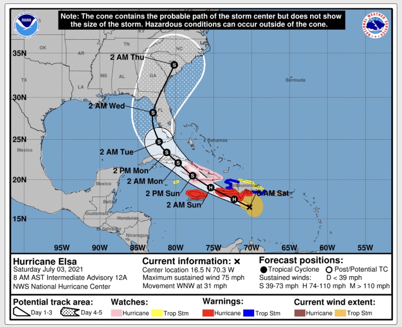
According to the National Hurricane Center, “There is an increasing risk of storm surge, wind, and rainfall impacts beginning Monday in the Florida Keys and spreading northward along the Florida Peninsula through Tuesday. However, the forecast uncertainty remains larger than usual due to Elsa’s potential interaction with the islands of Hispaniola and Cuba this weekend.
Interests throughout Florida should monitor Elsa’s progress and updates to the forecast.”
”Some mid-level wind shear associated with Elsa’s fast forward speed appears to be affecting the hurricane now. However, since the cyclone is expected to slow down and move beneath an upper-level anticyclone later this weekend, it seems likely that the vortex will become better aligned in the vertical. The big question is will Elsa be interacting with the mountainous islands of Hispaniola and Cuba when the environmental winds become conducive for strengthening. If the cyclone manages to stay south of those islands, Elsa could have an opportunity to restrengthen. Conversely, if the storm tracks directly over the islands, weakening would very likely occur. As a compromise, the NHC intensity forecast shows little change in strength through tonight, followed by slow weakening on Sunday and early Monday. Slight restrengthening is forecast when Elsa moves north of Cuba and across the eastern Gulf of Mexico. This forecast is a little lower than the previous one in the short term, but is largely unchanged at the longer forecast times.”
We will continue to monitor Hurricane Elsa and post regular updates.


